

Information
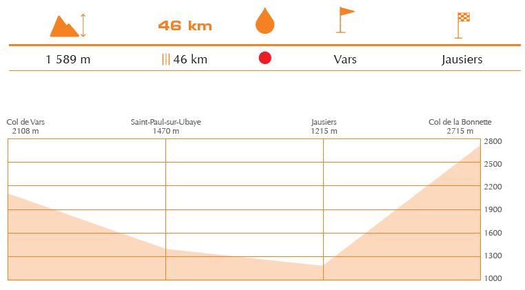
This section of the cross-border route, which is 46 km long, starts with 14 km of downhill road along the col de Vars, on the Alpes de Haute-Provence side, with average slope of 5.6% (it can reach 10%).The route then goes down along the Ubaye valley. Afterwards, in the village of Jausiers, you will start climbing the col de la Bonnette, the highest route in Europe (2.715 m, 24 kms, D+ 1.589m,% average: 6.6%, 9% max).