


Information
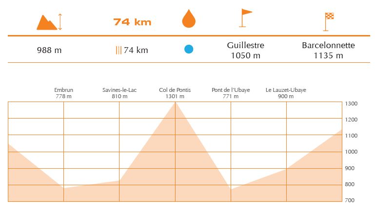
The section between Guillestre and Barcelonette crosses the Durace valley and leads to the Ubaye valley along the routes of the Tour de France 2017. The route unfolds along the Durance valley to get to the lake Serre-Ponçon and the Ubaye valley. Before the bridge of Savines-le-Lac, pedal towards Pontis and, if you like, climb up the Col de Pontis: you will thus cross one of the most beautiful beech woods in France (1.301 m, 4.40 km, D+: 356 m, % Average: 8.09% average, 17.8% max). You will be amazed by the downhill route along the Ubaye side of the lake. The route will then take you through the Ubaye valley to finally reach Barcelonette after 35km.