


The Cammino di Sant’Anna (St Anne’s Path) has a centuries-old history linked to the Sanctuary, located in a side valley of the Stura Valley at an altitude of 2035 m, in the place indicated in an apparition, as legend has it, by St Anne to the young shepherdess Anna Bagnis.
For decades now it has been a tradition for the inhabitants of the Cuneo area to tackle this route, leaving in the evening from various locations and arriving at their destination in the morning, after walking all night on the main asphalt road. This new route gives everyone the chance to experience the emotion of this walk, following the paths and historical routes of the Stura Valley. You will encounter unspoilt natural places, ancient chapels, isolated villages and the most beautiful historical centres of the various villages crossed.
Unlike other famous international itineraries, this one has a more limited overall length (65 km) and was created not only for its historical importance, but also to introduce novices to this type of territorial proposal and for those who are not used to or do not have the time to tackle longer and more demanding routes. Moreover, given the possibility of using it in a completely personalised way, reducing the number of days of walking or moving with a tent, it can also be a “training path” to prepare for longer pilgrimage routes.
The Path can be walked in four stages:
1 – Cuneo – Roccasparvera: 19.6 km – 400 m of altitude difference
2 – Roccasparvera – Demonte 17.2 km – 620 m of altitude difference
3 – Demonte – Vinadio 14.4 km – 620 m of altitude difference
4 – Vinadio – Sant’Anna Sanctuary 12.6 km – 1140 m of altitude difference
The accommodation facilities are located along the entire route and not only at the stage destinations. It is therefore possible to customise the days by modifying the length of each stage at will, making it take fewer days or starting in a different place.
The Stages

Stage 1: Cuneo – Roccasparvera
Length: 19.6 km | Height difference: 400 m | GPS Track
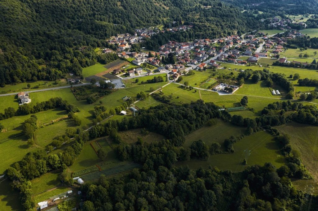
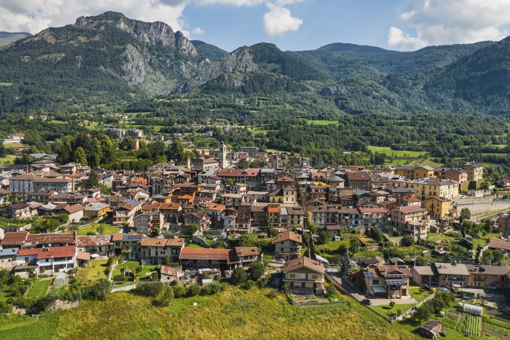
The first stage starts from Cuneo railway station or from Piazza Torino, passes in front of the ATL del Cuneese office, where it is possible to buy the credential, and continues into the old town centre through Piazza Galimberti. Then, it descends towards the Gesso and Stura River Park, following its paths along the Gesso stream as far as Borgo S. Dalmazzo. We enter the historical part through the arch of San Rocco to shortly reach the Abbey of San Dalmazzo. From here it goes towards the church of Sant’Anna, located near the Deportation Memorial, and then back towards the centre. Crossing several streets set between the walls of the houses, we leave in the direction of the Stura Valley, taking the ancient Via Perosa through meadows at the bottom of the valley and mixed woods, as far as Roccasparvera. The last stretch is an easy walk along a secondary tarmac road to the hamlet of Castelletto or Gaiola (depending on where you choose to stay overnight).
Stage 2: Roccasparvera – Demonte
Length: 17.2 km | Height difference: 620 m | GPS Track
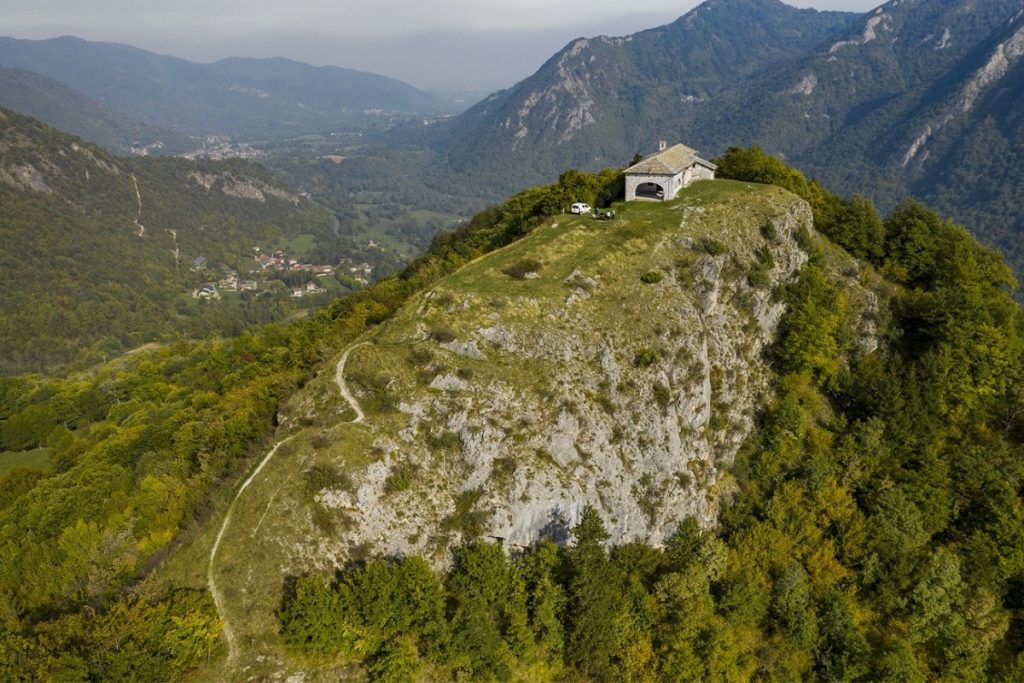
The second stage begins on the old medieval route, passing in front of the chapel of San Bernardo and crossing the village of Gaiola towards Valloriate. Barely touching the side valley, the route continues along small roads and paths to Moiola, where an easy climb begins along the ancient Via d’la Madona to the Chapel of the Incoronata (or Assunta), a wonderful panoramic spot overlooking the lower and middle valley. Still on the path, a slow and gradual descent begins to the hamlet of San Lorenzo, from where you continue on the tarmac road. Pass by the Porta di Valle (Valley Gate) and continue through the meadows beside the San Marco lakes. There is still a short climb to the hamlet of Cornaletto, to close the descent towards Demonte, crossing the Rio Cant on the old bridge.
Stage 3: Demonte – Vinadio
Length: 14.4 km | Dislivello: 620 m | Traccia GPS
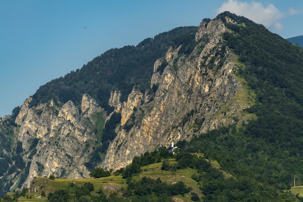
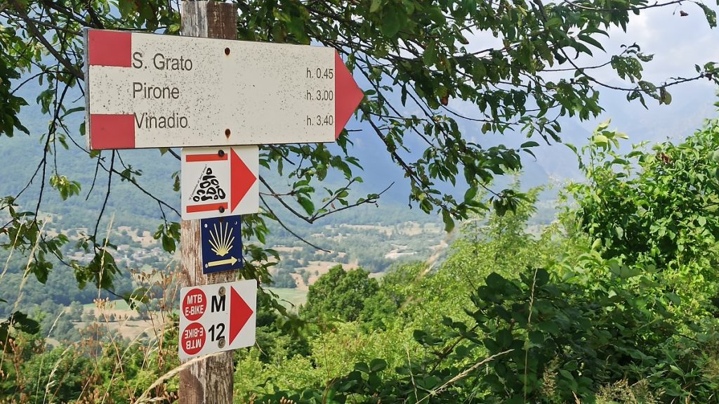
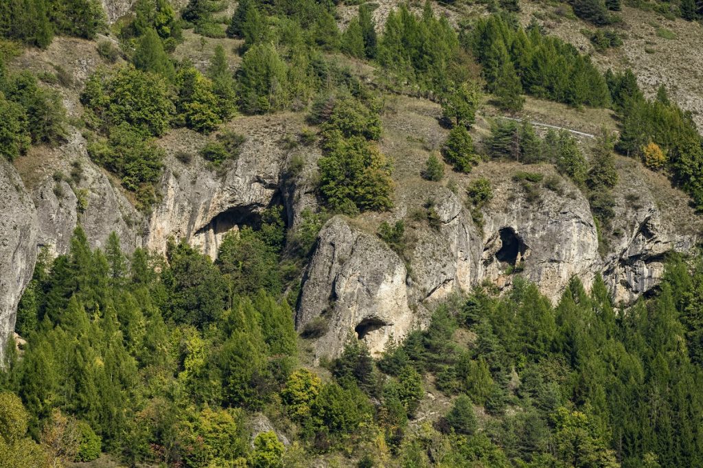
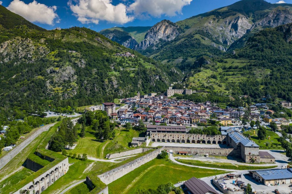
The third stage runs almost entirely on the sunny side of the valley, offering continuous spectacular views. From Demonte the trail climbs towards the Chapel of the Madonna del Pino (reached by a short diversions). Continue along a path halfway up the hillside that slowly loses height as far as the hamlet of San Grato, from where a dirt road continues as far as the main road, which must be crossed by means of a subway. Across the wide meadows you reach Aisone, entering the historic streets as far as the main square. Crossing the village you take the first part of the Grotte path, which you ignore in the second part to climb up to the hamlet of Pirone. Here begins a spectacular traverse on walls that are vertical in places but always safe, until you reach the hamlet of Castellar delle Vigne, already in the territory of Vinadio. Gradually descend on tarmac to Vinadio, where the stage ends.
Stage 4: Vinadio – Santuario di Sant’Anna
Length: 12,6 km | Height difference: 1140 m | GPS Track
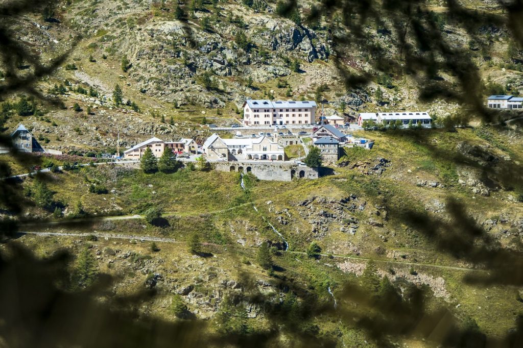
The fourth and final stage of the Cammino di Sant’Anna represents the real climb towards the Sanctuary. It starts from Vinadio, walks towards the lake of the Forte and, crossing the Stura di Demonte river, reaches the hamlet of Pratolungo. A little further on, the ascent to the Sanctuary begins. It faithfully follows the historic route taken by pilgrims from the Cuneo area who usually set off in the evening to arrive up in the morning. This path climbs up the valley on the opposite side of the asphalt road, allowing you to walk in a wild, completely natural environment, far from motorised vehicles. You gain height in a constant manner until you reach the large glacial plateau, from which you begin to see your goal; after crossing it, you begin the final ascent to your destination.
Nota
The route is completely marked from the start of the Cuneo railway station (and alternatively also from Piazza Torino – the bus stop) to the finish line, with red and white signs bearing the logo of the Path.

You will find stickers on metal supports, signs and plaques on hiking poles. Only on the final climb do the colours change to blue and yellow because the route coincides with the existing traditional path.
THE ASSOCIATION “THE PATH OF SANT’ANNA”
The Association was formally born on 11 February 2008 with the desire to promote the meaning and realisation of the “Path”, of the Pilgrimage, seen as a metaphor for Life itself. It has played a very important role in the realisation of this project, thanks to the dialogue between the Mountain Union and the sharing of objectives. For more information and to support them, we invite you to visit their website.
Short variants
The proposed variants are not to be considered as “extras”, but as real icing on the cake. If you have the time, we recommend that you take the time to do them all, so as to enrich your experience even more.
- Variant – ascent to the Sanctuary of Monserrato (stage 1): 2.5 km in length and 100 metres in height difference. This is a variant that leads to the beautiful Sanctuary, with beautiful views over the plain. The alternative route ends just outside Borgo San Dalmazzo. GPS track
- Ascent to the ruins of Roccasparvera Castle (stage 1) + 1 km and 30 metres of climbing. Round trip. GPS track
- Variant to the Grotte di Aisone (stage 3), length 2 km and a difference in altitude of 135 metres. The variant adds about 60 metres in height difference and 700 metres in development to the stage and takes place on a hiking trail, which is steep in parts. GPS track
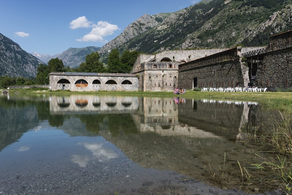
- Variant – ascent to Forte Neghino (stage 3), length 6.1 km, difference in altitude 270 metres. The variant adds around 250 metres in height difference and 5 km to the stage, but the distinctive elliptical fortress and the view from the panoramic terrace over Vinadio are certainly worth the extra effort. GPS track
Attention: the variants are not marked on the ground, so it is necessary to download the GPS tracks in order to be sure to follow them safely.
On the hottest days of the summer, some passages may be more challenging due to the temperatures; it is therefore advisable to stop in the middle hours at a cosy inn in the valley or under the shade in a forest.